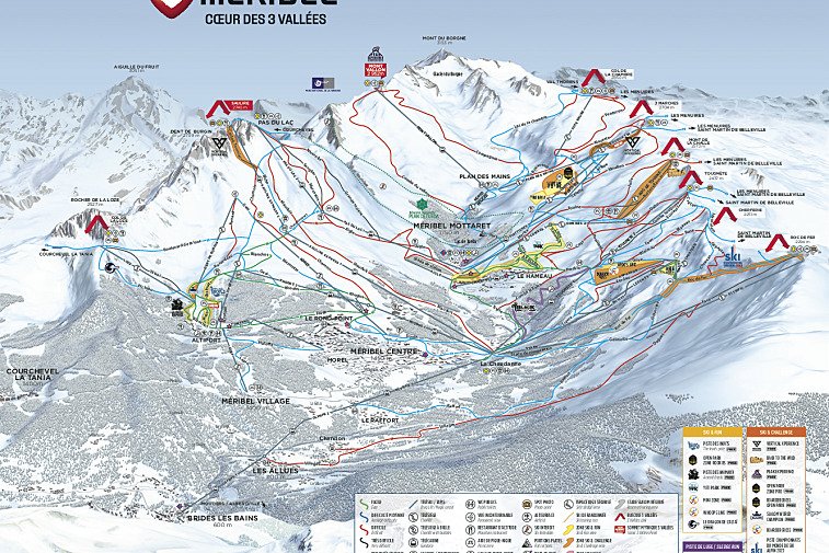
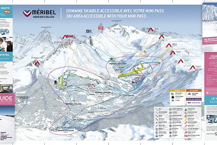
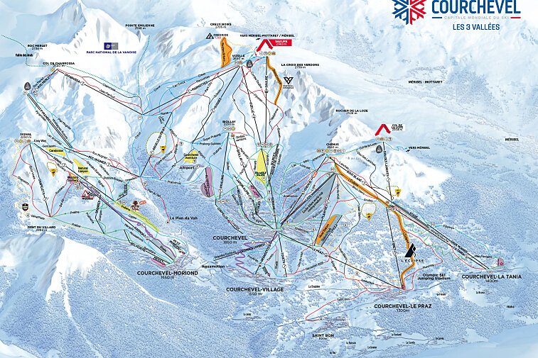
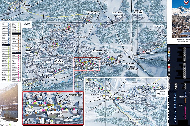
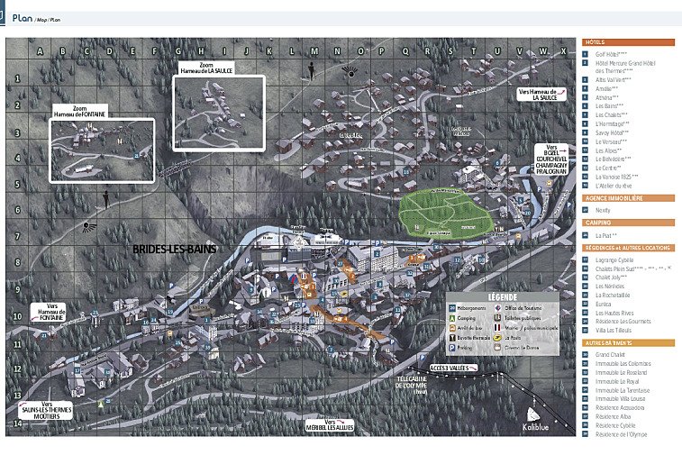
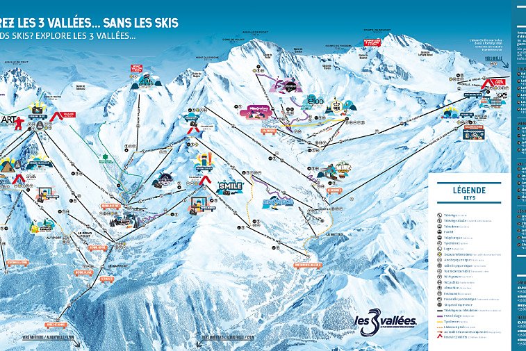
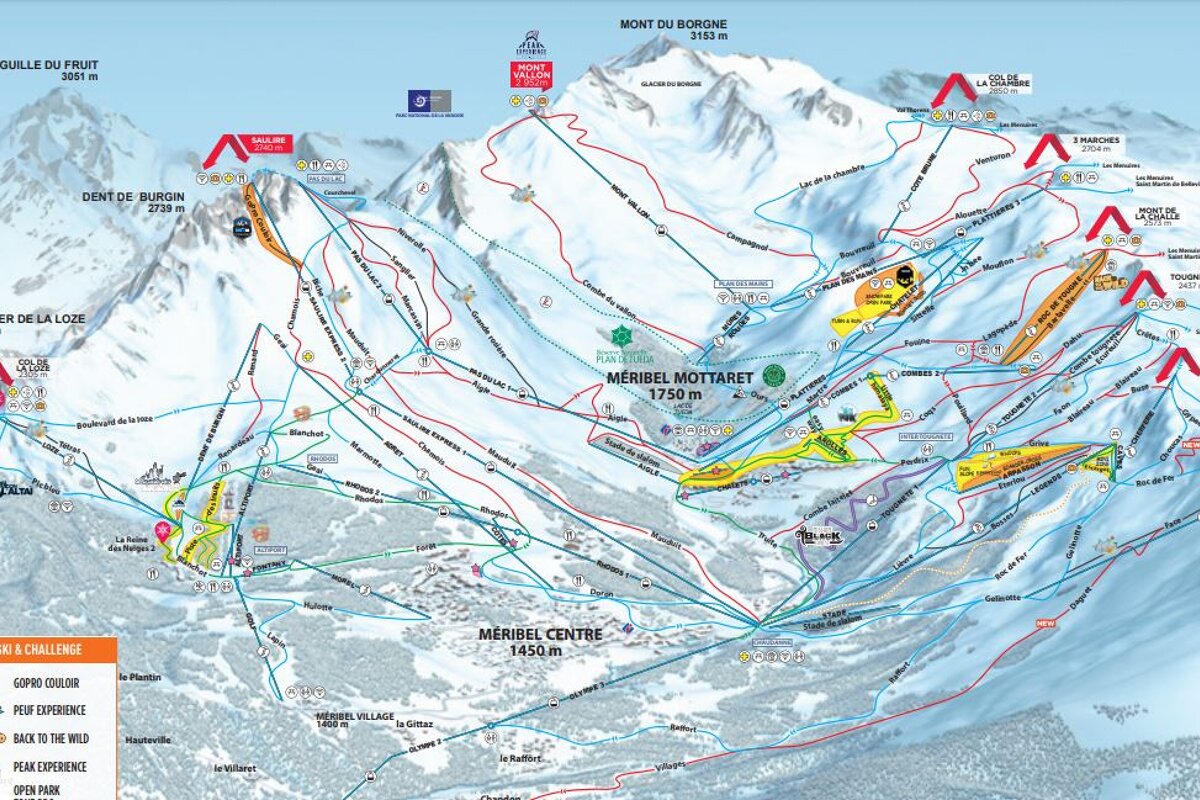
Where are you staying?

SeeMeribel

Maps of Meribel

Download the essential Meribel maps and plans

Updated

We hope this selection of piste and lift maps, street maps, and activity area maps for Meribel will help you find your way around so you can make the most of this great part of the world.

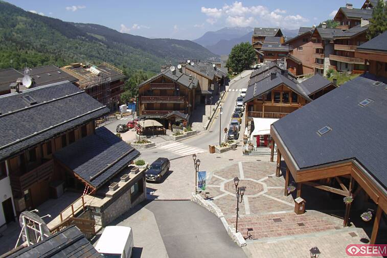
Méribel is situated in the heart of the Three Valleys and, whilst the principle town is of the same name, Méribel is often used in reference to the whole valley. It is, however, made up of several distinct and charming villages including Mottaret, Les Allues and Méribel Village, each with its own distinct ambiance.

Méribel is situated between 1,450m and 1,700m, with the separate satellite village Méribel-Mottaret sitting higher at 1,700-1,800m. Lower in the valley are several traditional villages, with Les Allues and Raffort linked to the main lift system by gondola.

Piste maps


Méribel piste and ski lift map
Meribel Mini-Pass piste and ski lift map
3 Valleys piste and ski lift map
3 Valleys Interactive piste and ski lift map
3 Valleys Easy Rider piste and ski lift map
Courchevel piste and ski lift map
Courchevel Mini Pass piste and ski lift map
Val Thorens piste and ski lift map
Les Menuires - Saint Martin piste and ski lift map 
Méribel piste maps

Lifts marked on the piste map using straight black lines are of four types: button tow/drag lift, chairlift, télécabine and télephérique. They have the corresponding abbreviations:

  • TK - téléski (drag lift)
  • TS - télésiege (chairlift)
  • TC - télécabine (gondola)
  • TPH - téléphérique (cable car)

Anything prefixed/suffixed with “Express” means a six-person, fast chairlift.